In February of 2023, we set out hoping to see four waterfalls just north of Mehama.
Horseshoe Falls, Ayers Creek Falls, and Upper Ayers Creek Falls are very close together just off of Ayers Creek Road. When we got there, however, the road was blocked. The land is now owned by Weyerhaeuser, and visitors must make prior arrangements for a recreation permit to gain access. Since we left a voicemail and emailed Weyerhaeuser but never heard back, I can’t provide any tips for those of you who’d like to pursue the recreation permit. In addition, the permits are a bit spendy, so unfortunately I am removing those three waterfalls from my list.
The day wasn’t wasted, though! I had noticed Stout Creek Falls labeled on Google Maps, less than a mile away. I searched for more information, but I could only found one trip report about it online, so we weren’t confident about finding it or what to expect if we did.
Turns out, it’s not that hard to find. And it’s not too hard of a bushwhack, either. And it’s a very decent waterfall! Why on earth is there only one trip report about it in cyberspace?!
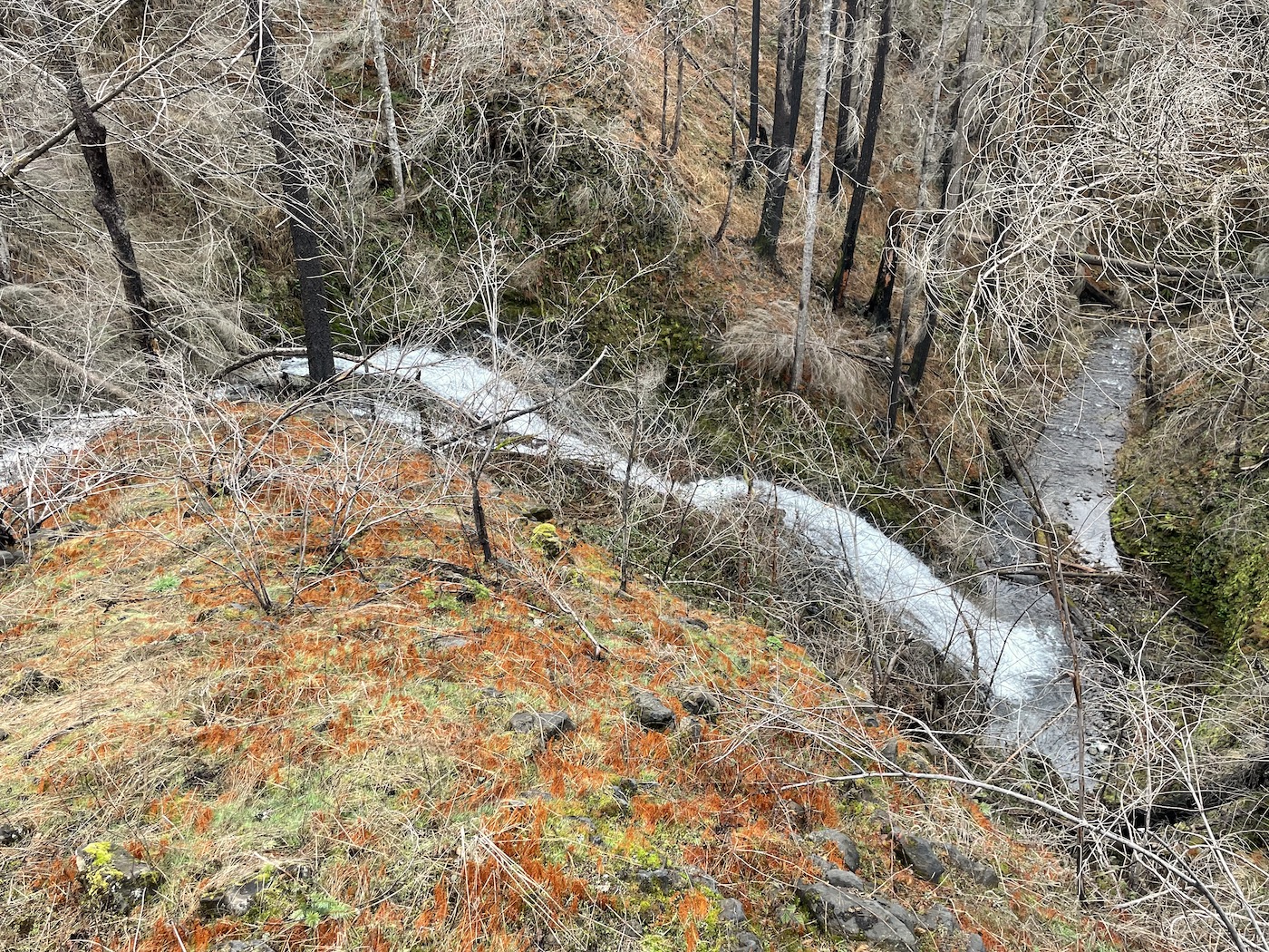
We carefully made our way down a steep slope to get a better view of the waterfall.
Since we still had plenty of time left in the day – and since we were close enough to civilization to have internet access – we did some on-the-fly research and decided to visit Salmon Falls, Elkhorn Falls, and Triple Falls off of North Fork Road.
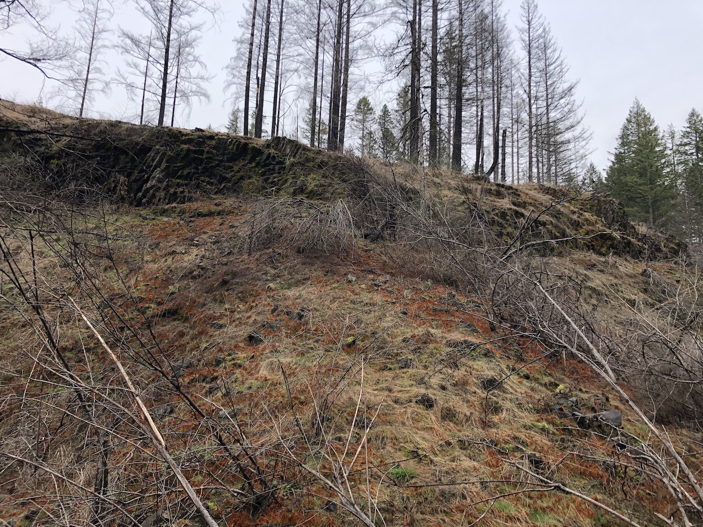
This area was severely damaged by the fires of 2020, and the trails here had been closed ever since. I was surprised when my quick research indicated that the Little North Santiam Trail (which leads to Elkhorn Falls and Triple Falls) might be open. When we reached the trailhead, though, we were disappointed once again. The trail was clearly marked closed, and we decided the sign at the trailhead was more authoritative than my quick web search. (My web search today shows once more that the trail should be open… Hopefully we’ll be able to visit successfully soon!)
We did stop at Salmon Falls on the way there. Salmon Falls is viewed from Salmon Falls County Park, and the open/closed status of the park was ambiguous. There was a sign indicating that the park was closed, but the sign was on the gate, and … the gate was open. (How’s that for a mixed message?!) We decided to go ahead and take some pictures, but my web search today clearly indicates that the park is still officially closed to the public. Oops.
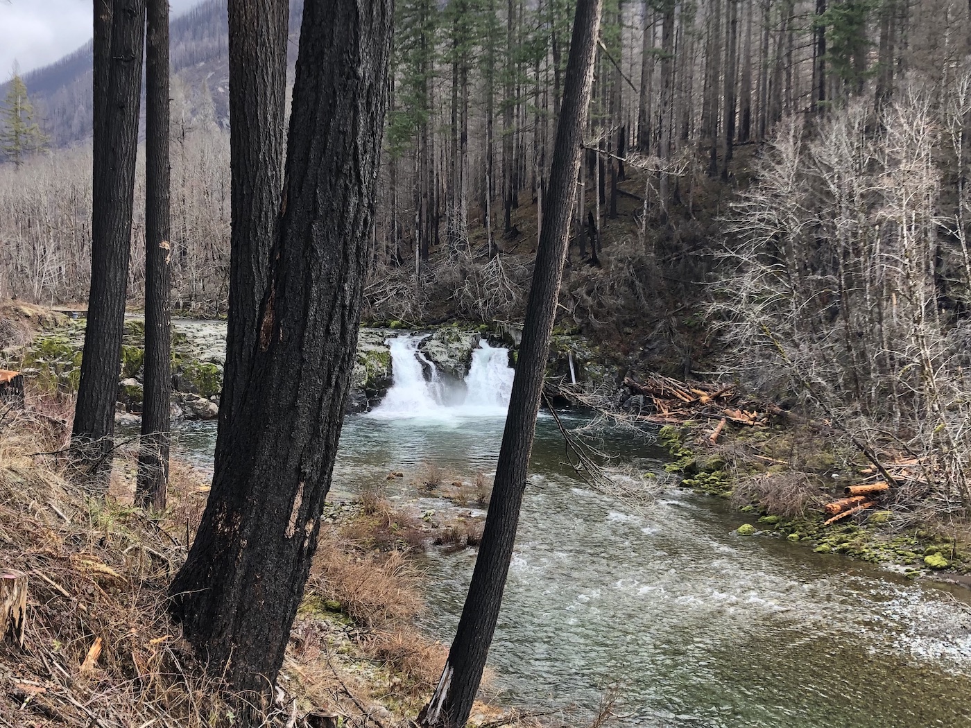
A lot of work needs to be done for the park to be fully functional again. The bathroom was destroyed by the fire, along with safety fences, signs, and anything else even slightly flammable.
This fire was devastating. On our drive, we saw many mobile homes along with a bit of new construction, and eventually we realized that people are living in trailers while they rebuild their houses. It’s heartbreaking to think of how many people lost everything and are still affected by the fires everyday, more than two years later.
When the park was open, it was a popular swimming and fishing spot. Perhaps it will become so again one day.
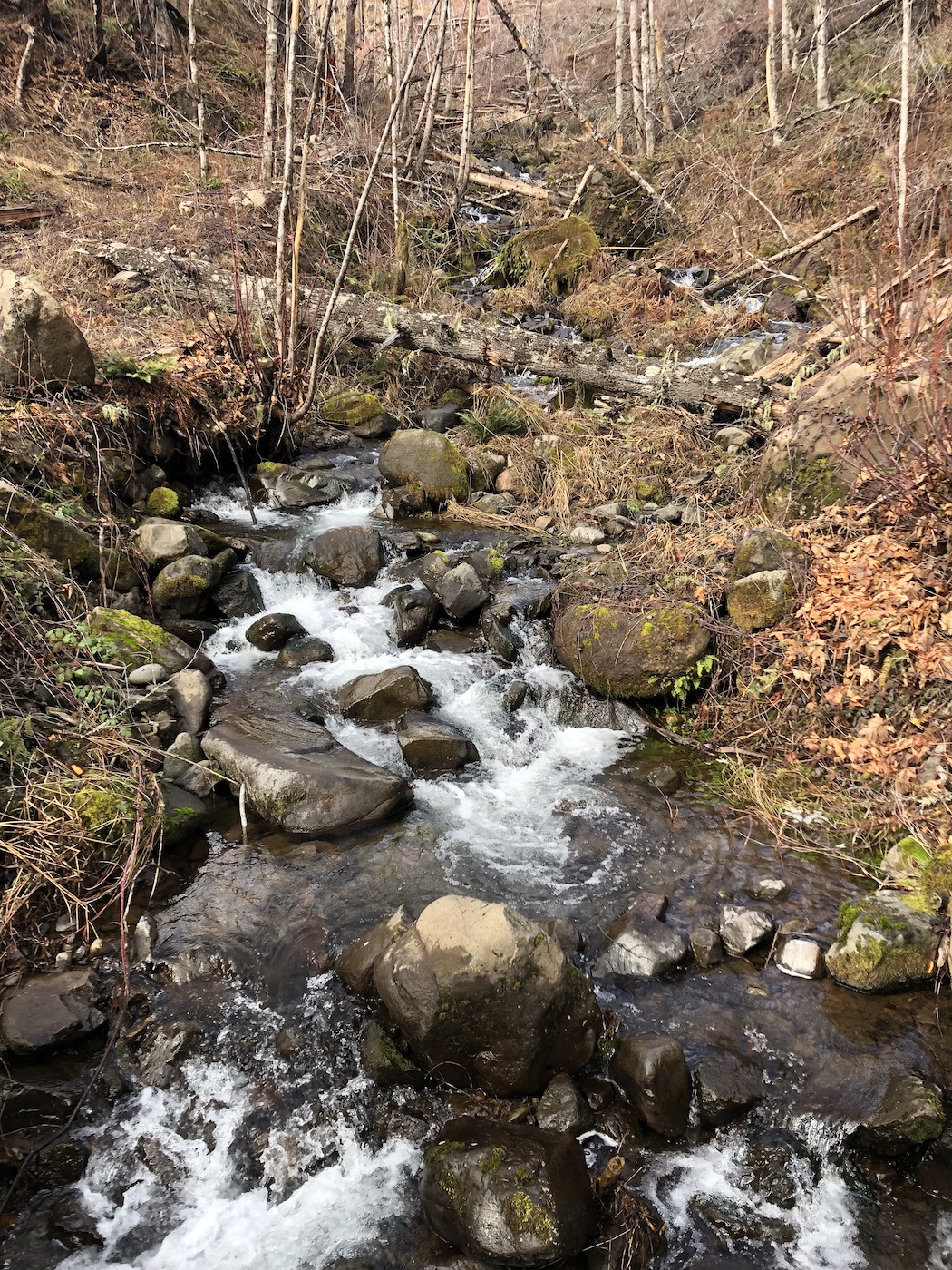
Across the road from Salmon Falls County Park, Fawn Creek slides down the hill, and I was tempted to call it a waterfall. In the end, I decided it just isn’t vertical enough to be considered a legitimate cascade.
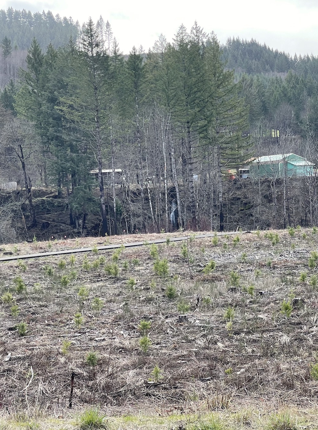
As we drove back, we discovered one more waterfall that meets the minimum requirements. It’s a distant view, and there is nothing noteworthy about it all, but I’m counting it anyway. Can you spot it in the middle of the photo below?
SUMMARY:
My rating:
Stout Creek Falls: Highly Recommended (3 stars) (Waterfall – 3 stars, Trail – 2 stars, Experience – 3 stars)
Salmon Falls: Worth the Effort (2 stars) (Waterfall – 2 stars, Trail – N/A, Experience – 2 stars)
Unnamed Waterfall: Low Priority (1 star) (Waterfall – 1 star, Trail – N/A, Experience – 1 star)
Distance from Beaverton: About 1.25 hours drive southeast to Stout Creek Falls and another 30 minutes to Salmon Falls
Nearest town: Mehama
Nearest city: Salem
County: Marion
Length of round-trip hike:
Stout Creek Falls: About half a mile
Salmon Falls: About one-tenth of a mile
Unnamed Waterfall: None
Best season to visit: Any. Once Salmon Falls County Park is reopened, you may want to visit in the summer to go swimming.
Consider combining this trip with: Elkhorn & Triple Falls, Henline Falls, or Shellburg Falls
Toilet / Amenities: None as of early 2023. Once the park is repaired, picnic tables and a toilet should be available at Salmon Falls.
How to get there:
- From the intersection of Hwy 22 and Golf Club Road in Sublimity, travel east on Highway 22 for 10.9 miles.
- In the town of Mehama, turn left on Teeters Road, and then make an immediate right onto Wagner Road.
- After 2.4 miles, Wagner Road bends sharply to the right. Stay straight here to “turn” onto Ayers Creek Road. This is not well marked.
- Cross the creek and then turn right.
- In another 0.6 mile, turn right again. This road is not well maintained. There are a couple of places to park on the left.
- Walk in the same direction as the road, but veer slightly to the left. As you approach the creek, you’ll hear the waterfall. Be careful and cautious in choosing a path down the slope! (Yes, I was redundant on purpose. Safety first!)
- To visit Salmon Falls, return to Hwy 22 and turn left. Drive 0.7 miles and turn left on North Fork Road. This road is well marked. (Note that this turn is a total of 11.6 miles from the intersection of Hwy 22 and Golf Club Road in Sublimity.)
- Salmon Falls County Park will be on your right in 13.8 miles.
- To view the Unnamed Waterfall (labeled as Unnamed Waterfall #2 (N Fork Road) on my map), drive back towards Hwy 22. The waterfall can be seen to the left in 11.3 miles.
Helpful links:
