I must begin this post with a confession and an apology: I am writing these words a year and a half after our trip.
Pathetic, I know. I will do my best to remember details, but here’s what I know for sure: This trip was AMAZING!
I’m going to describe this adventure as one big trip, but I’ll split it into several posts so it’s not overwhelming. Why would it be overwhelming, you might ask?
Good question. I’m so glad you asked. One post about this trip would be overwhelming because in one day, we saw 41 waterfalls.
That’s right. Forty-one! FORTY-ONE!!!
We started and ended our day in the little town of Powers. There had been a lot of rain the week prior to our trip, so all of the streams and rivers were flowing at full volume, and there were plenty of seasonal streams as well.
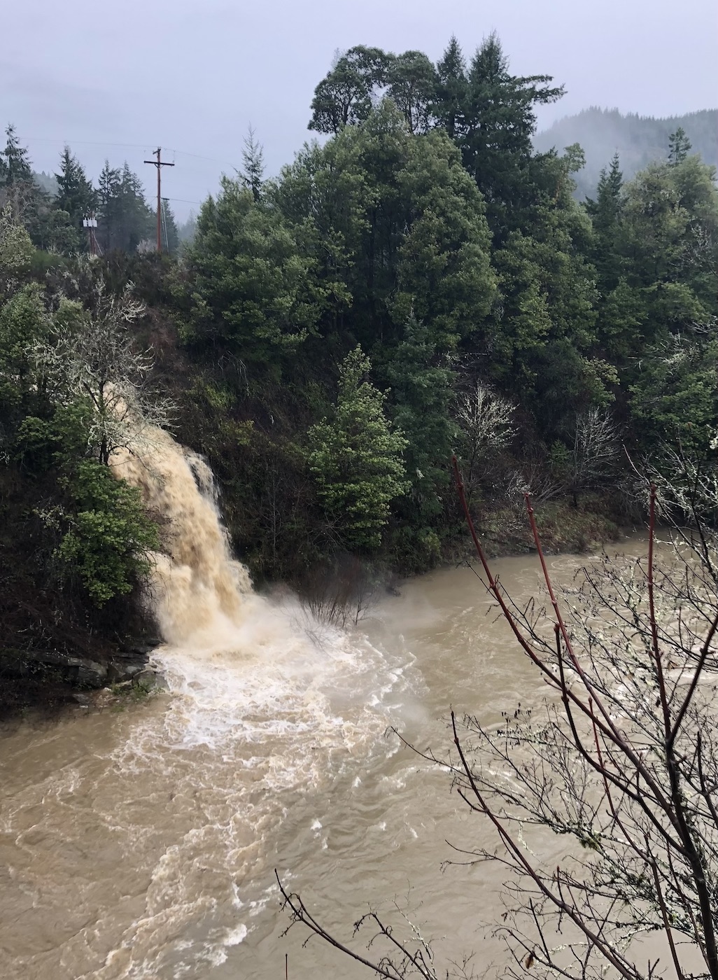
Our first stop was Mill Creek Falls, located on the outskirts of Powers. A lot of mud was mixed into Mill Creek due to the recent rain, turning the waterfall brown.
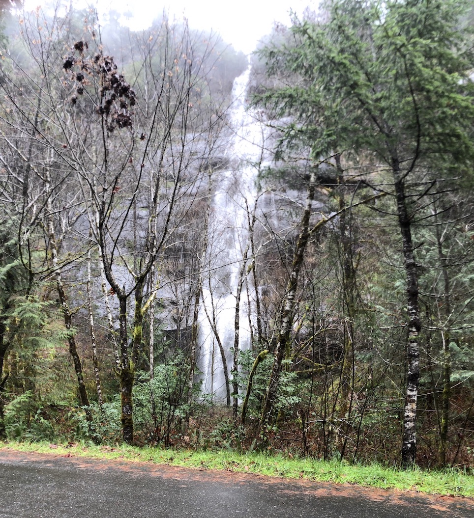
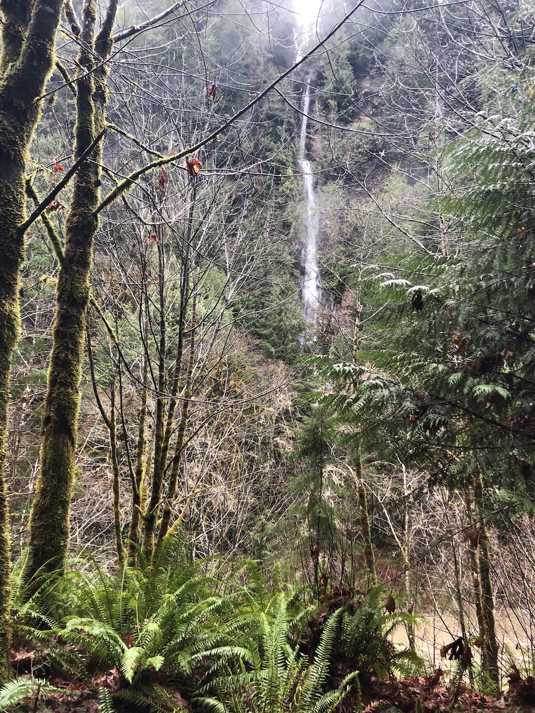
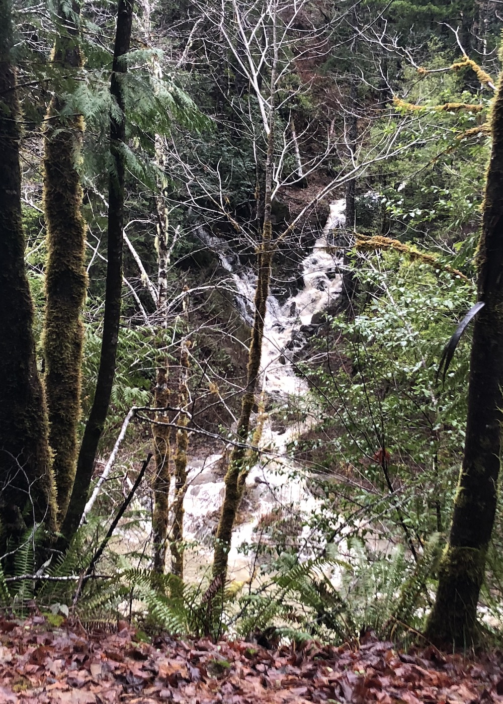
Next, we headed to Elk Creek Falls and found an unnamed roadside gusher close to the trailhead. At the time, it was the best roadside waterfall I had encountered. That was soon to change.
The trail to Elk Creek Falls leads to two waterfalls, the first of which is nameless. I suspect it dries up in the summer.
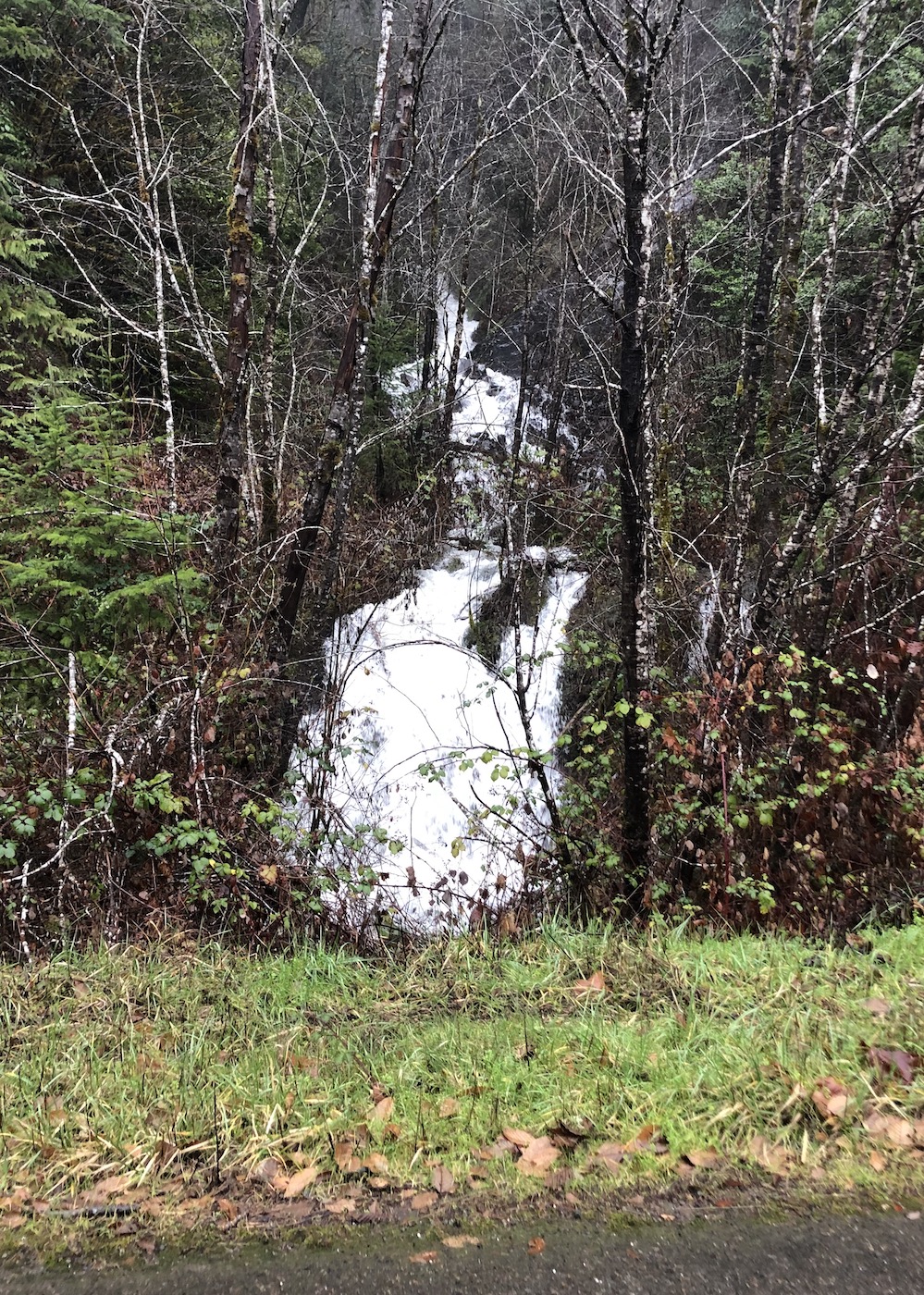
The second is, of course, Elk Creek Falls. In January, the creek was surging, but I’ve seen photos of a much tamer waterfall in other seasons – so much so that it’s hard to believe that this is the same spot.
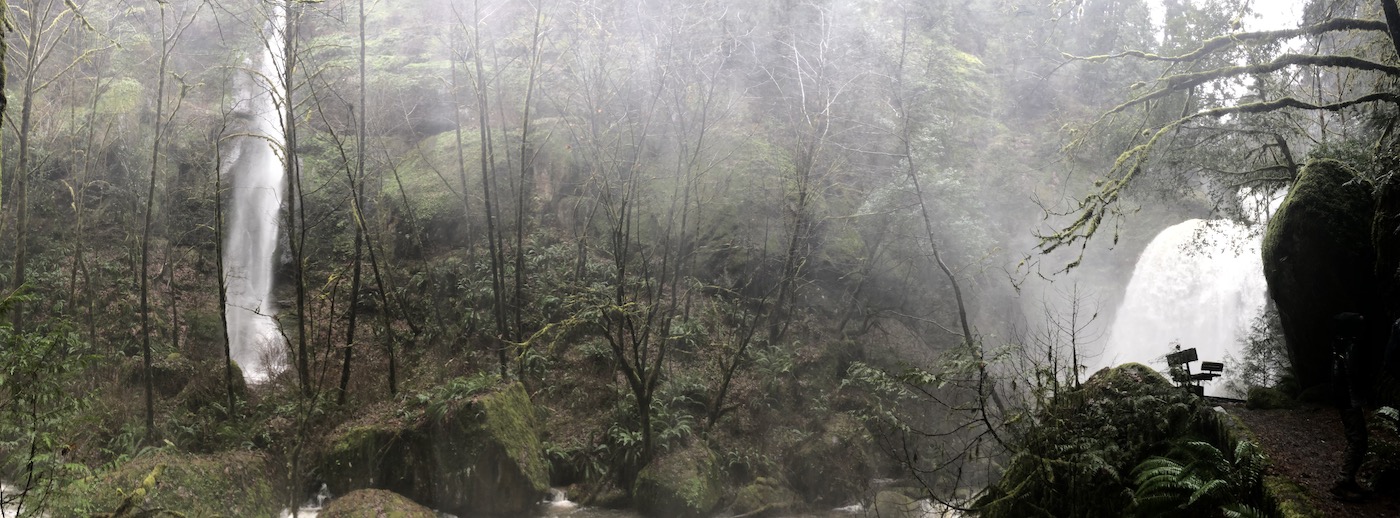
The two waterfalls are close enough together to be viewed at the same time and photographed with a panoramic feature, as shown above.
Back on the road, we soon spotted three waterfalls in a row across the South Fork Coquille River.
I assume these streams dry up in the summer as well, but they made for fun hunting in January.
The next waterfall was also an unexpected find across the river, but farther down the road.
The next two waterfalls were next to the road, on the near side of the river.
We like to listen to audiobooks in the car, but on this day we would start and pause, start and pause, because of all of these unanticipated cascades!
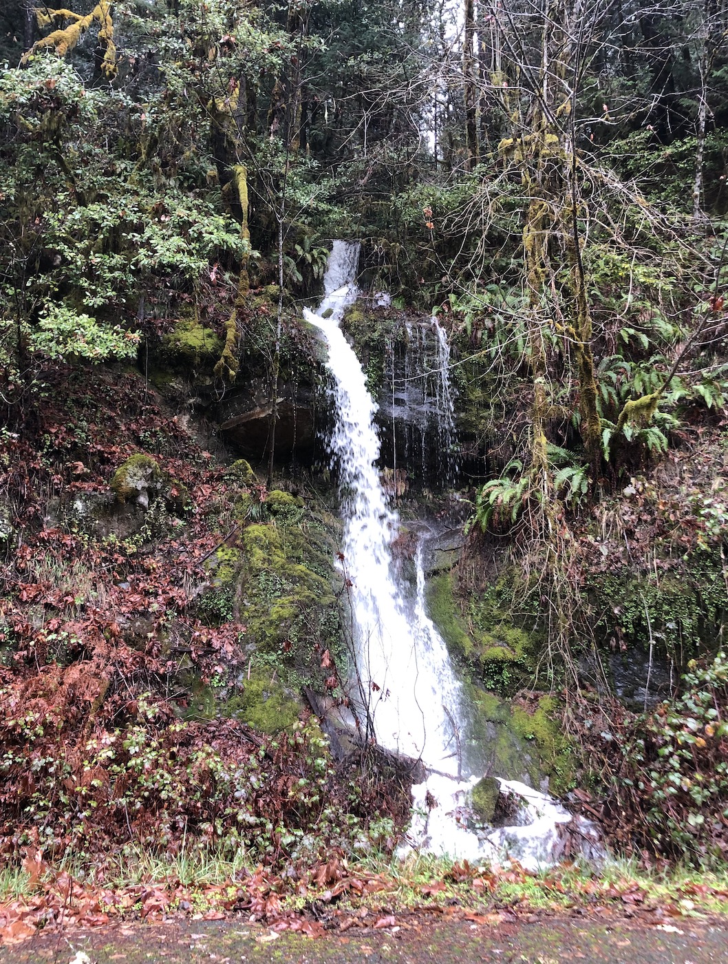
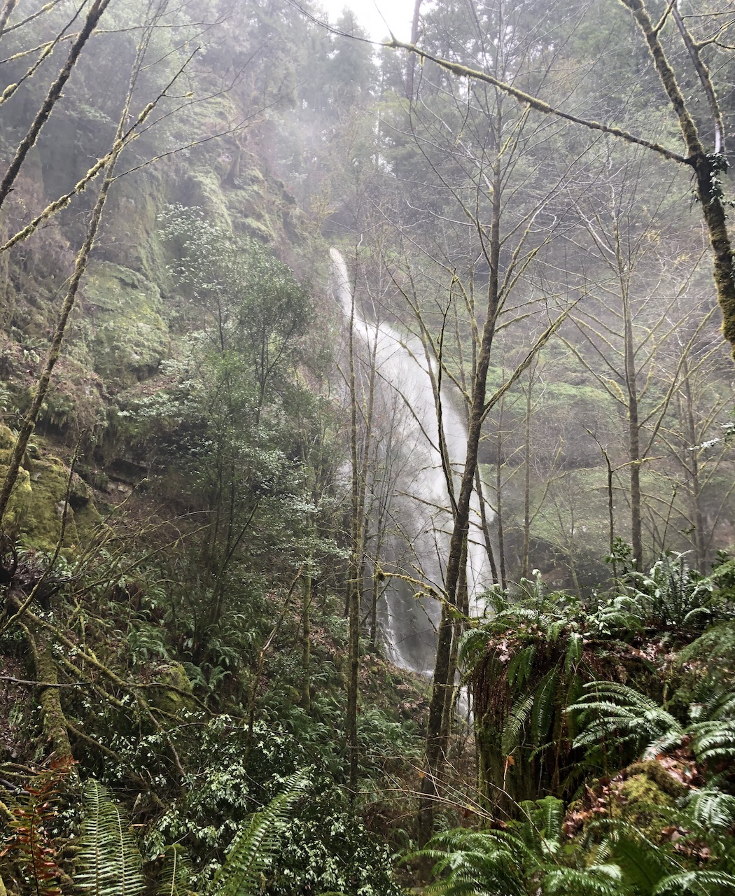
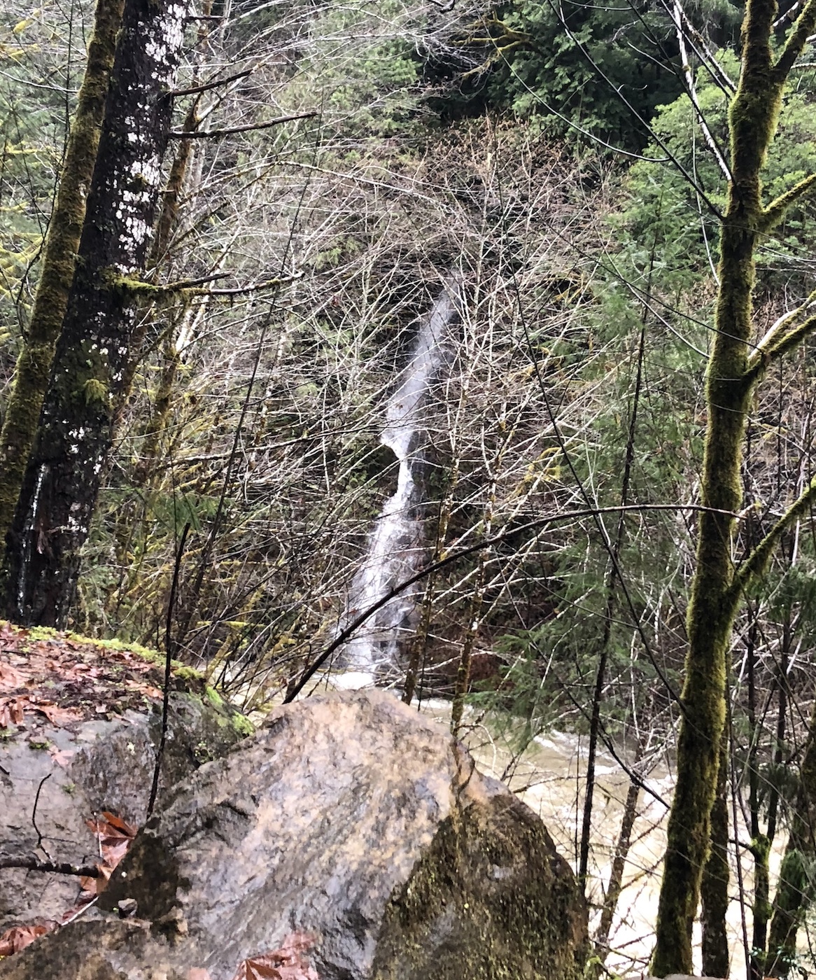
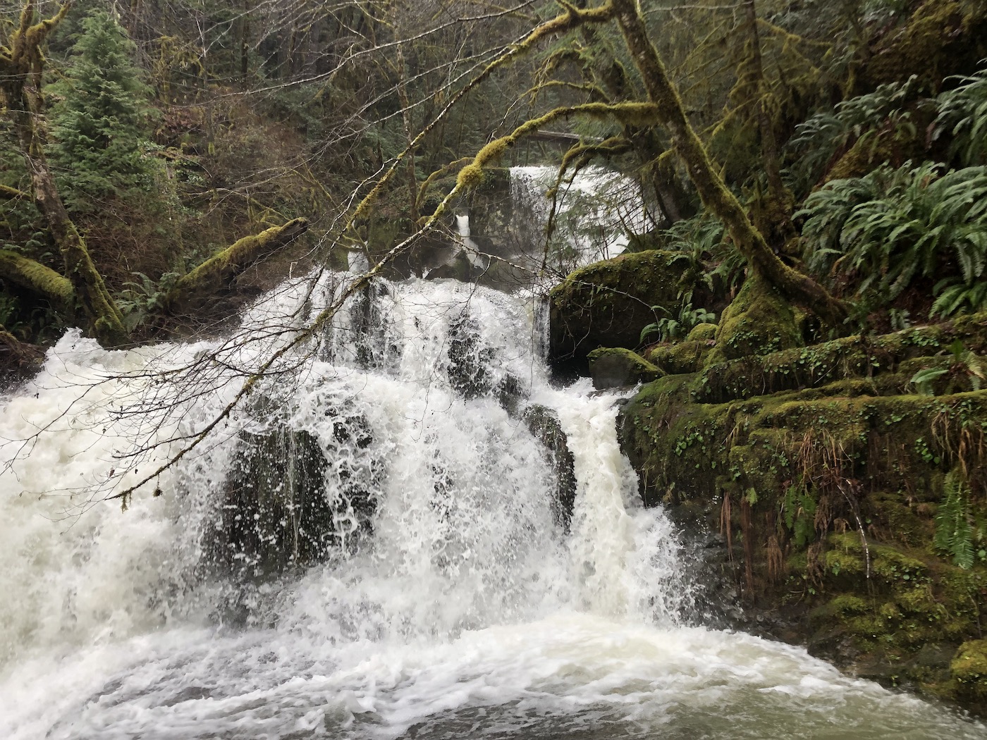
Shortly hereafter, we left Road 33 for Road 3348 and encountered Upper Sru Creek Falls flowing under a bridge.
My husband made his way to the base of the bridge to capture the photo below.
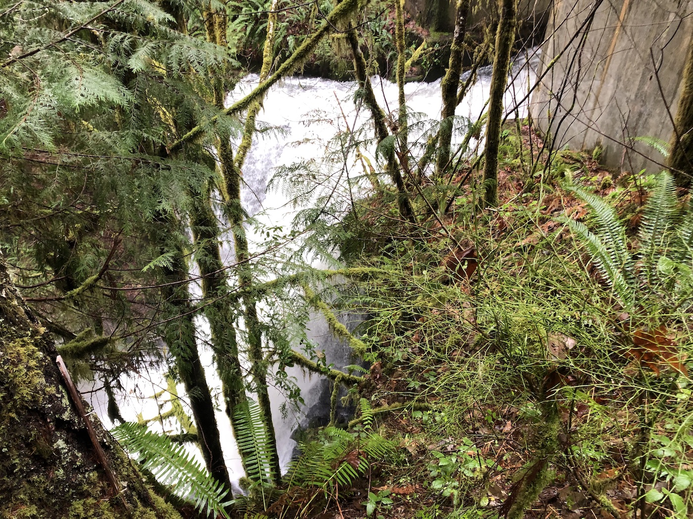
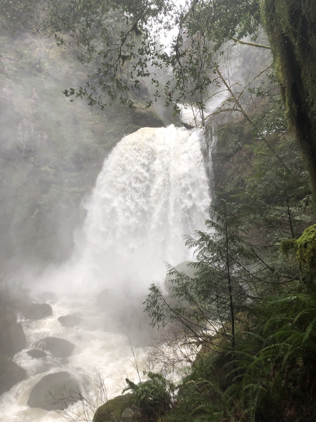
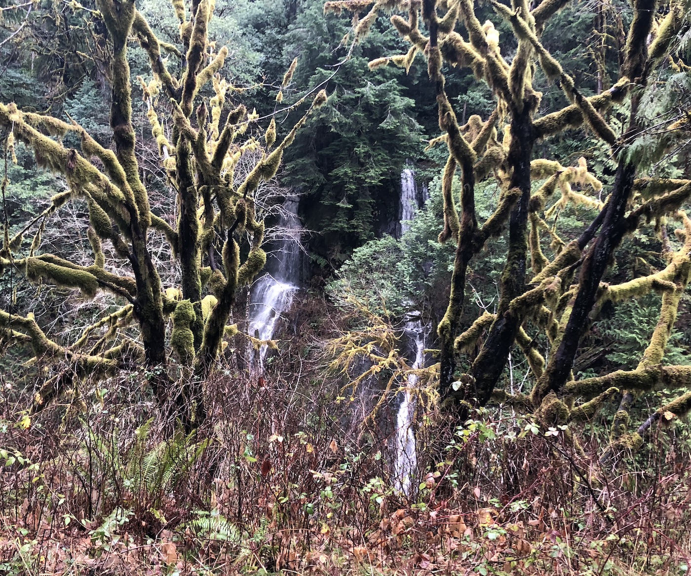
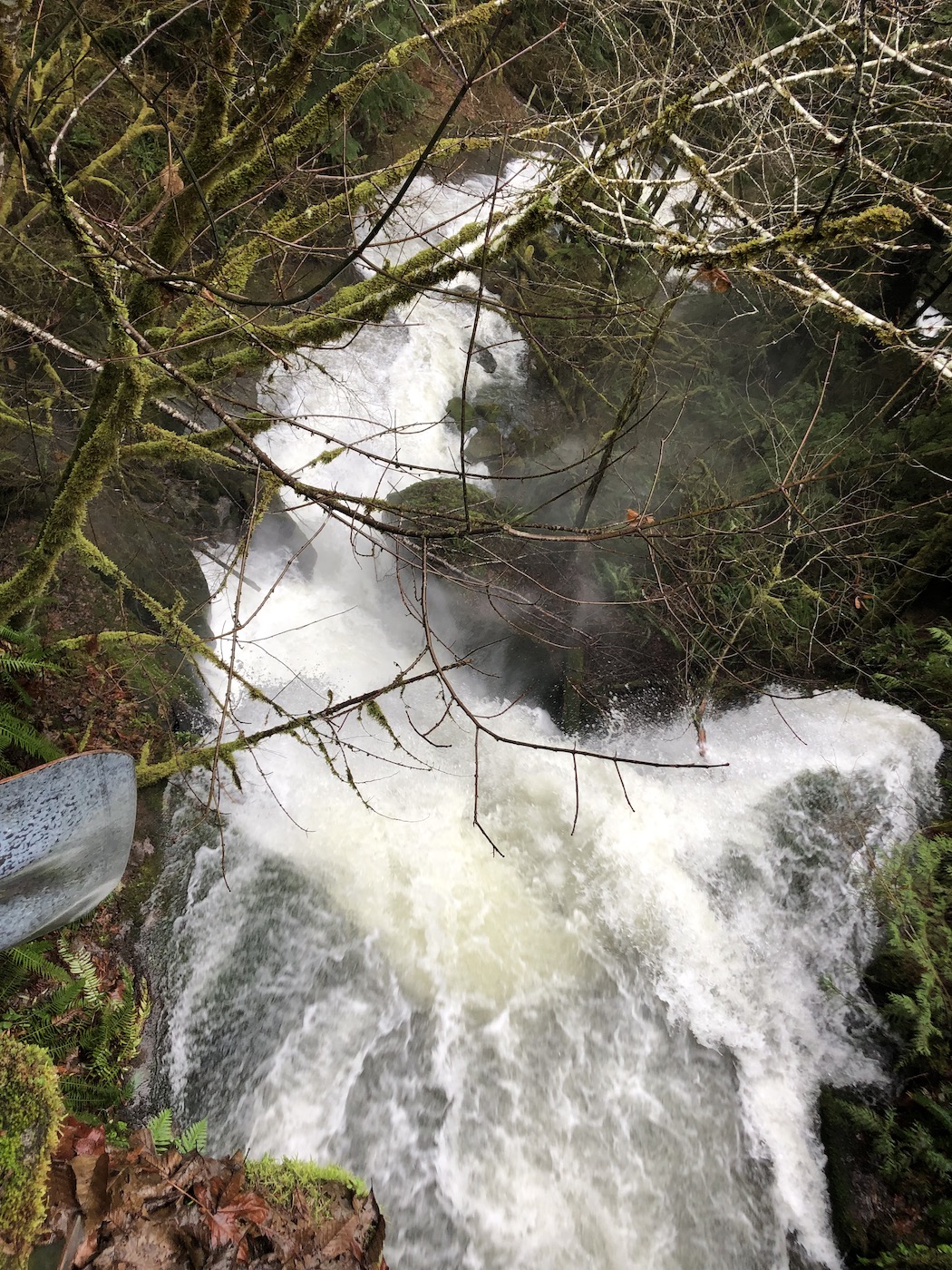
Just a tenth of mile away is the trailhead to the crown jewels of the trip: Coquille River Falls and Drowned Out Creek Falls.
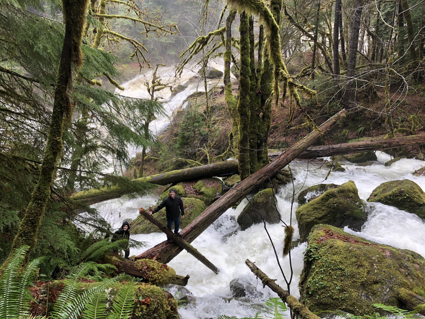
This spot would be gorgeous with just one waterfall, anytime of year. Moss, ferns, boulders, fallen trees – it’s fantastic. But two waterfalls in one place makes it breathtaking. And in the middle of winter…
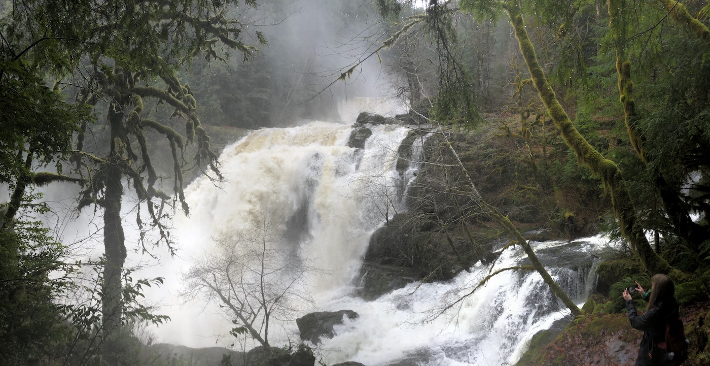
Awe-inspiringly powerful. Jaw-droppingly beautiful. Absolutely a Must-See.
We were soaked by the time we were done exploring and taking photos here, but not from the rain – from the spray! But we didn’t mind at all. It was truly an amazing experience.
And that is where I will wrap up Part 1 of this epic adventure. Click here to continue with Part 2.
SUMMARY:
My rating:
Elk Creek Falls, Unnamed #1 & #2: Highly Recommended (3 stars) (Waterfall – 3 stars, Trail – 3 stars, Experience – 3 stars)
Coquille River Falls & Drowned Out Creek Falls: Must See / Favorite (4 stars) (Waterfalls – 4 stars, Trail – 3 stars, Experience – 4 stars)
Mill Creek Falls, Upper Sru Creek Falls, and Unnamed #3-8: Low Priority (1 star) (Waterfalls – 1 star, Trail – n/a, Experience – 1 star)
Distance from Beaverton: 4 hours southwest
Nearest town: Powers
Nearest city: Eugene
County: Coos County
Length of round-trip hike:
Elk Creek Falls: 0.25 mile on the trail plus another 0.25 mile along the road to Unnamed #1 and back
Coquille River Falls & Drowned Out Creek Falls: 1 mile
All others: N/A
Best season to visit: Winter or early spring.
Things to know: The Elk Creek Falls Trail also leads to the Big Tree Trail, which leads to the world’s largest Port-Orford cedar tree.
Consider combining this trip with: Epic Coos County Adventure – Part 2 & Part 3
Toilet / Amenities: None
How to get there:
- Make your way to the town of Powers and find the intersection of Highway 219 (Powers South Rd aka Rogue-Coquille Scenic Byway) and Johnson Mountain Rd (Road 3363).
- Turn south on Johnson Mountain Road, cross the Coquille River, and park close to the bridge. Walk back onto the bridge for views of Mill Creek Falls.
- Return to Hwy 219 and turn right. Drive 5.7 miles to the Elk Creek Falls trailhead. (The highway becomes Road 33 at 4.8 miles.) If desired, walk back a short distance along the road for views of Unnamed Waterfall #1.
- Continue driving south on Road 33. Look for Unnamed #3 after 0.2 mile.
- Unnamed #4 is another 0.2 mile, and Unnamed #5 is another 0.2 mile after that.
- Drive 3.8 miles to view Unnamed #6.
- Unnamed #7 is another 1.7 miles, and Unnamed #8 is 3.3 miles past that. (Unnamed #8 should be about 9.2 miles from the Elk Creek Trailhead, and my numbers are adding up to 9.4, so I’m a little bit off on some of these. Hopefully this is close enough to help you out, though!)
- Drive 1.2 miles further on Road 33 and turn left on Road 3348.
- Upper Sru Creek Falls is found 1.5 miles up Road 3348.
- The trailhead for Coquille River Falls and Drowned Out Creek Falls is an additional tenth of a mile.
Helpful websites:
- https://www.waterfallsnorthwest.com/waterfall/Mill-Creek-Falls-3840
- https://www.alltrails.com/trail/us/oregon/elk-creek-falls-trail
- https://www.fs.usda.gov/recarea/rogue-siskiyou/recarea/?recid=70038
- https://www.waterfallsnorthwest.com/waterfall/Elk-Creek-Falls-4247
- https://www.waterfallsnorthwest.com/waterfall/Upper-Sru-Creek-Falls-14819
- https://www.waterfallsnorthwest.com/waterfall/Coquille-River-Falls-3833
- https://www.fs.usda.gov/recarea/rogue-siskiyou/recarea/?recid=70026
- https://www.alltrails.com/trail/us/oregon/coquille-river-falls-trail
- https://www.waterfallsnorthwest.com/waterfall/Drowned-Out-Creek-Falls-3832

2 Comments Add yours